So You Want to Know About Maps?

Tuesday, July 24, 2012
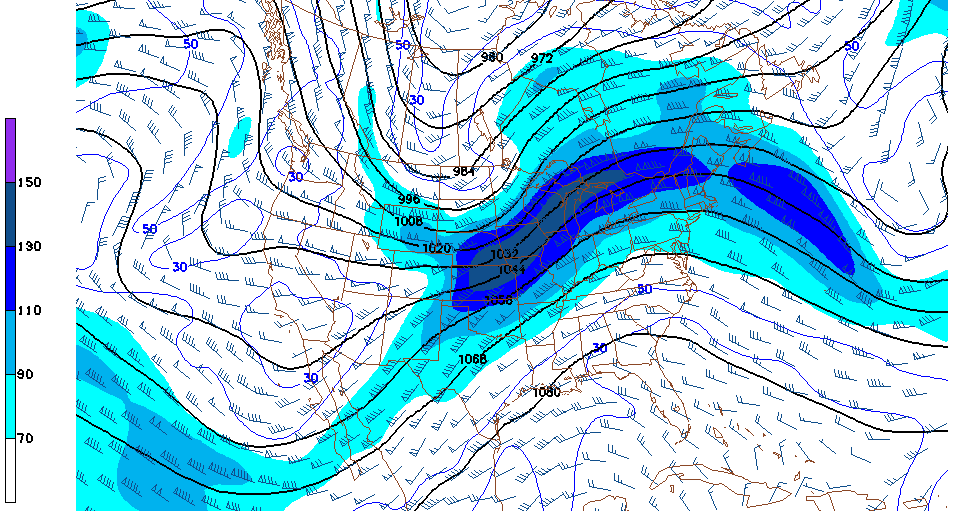
Isotachs


This isotach map branches over Kansas, Nebraska, and Iowa.  Isotach maps are used in meteorology to express wind speeds of an area.  These maps like isobar maps also have connecting lines at points of equal speeds.

Isotach Maps
Posted by mississippinole at 8:12 PM
Email ThisBlogThis!Share to XShare to FacebookShare to Pinterest

No comments:

Post a Comment

Newer Post Older Post Home
Subscribe to: Post Comments (Atom)

Blog Archive

  • ▼  2012 (50)
    • ▼  July (50)
      • Lorenz Curve
      • Graduated Symbol Map
      • Box Plot
      • 3D Map
      • Similarity Matrix
      • DLG map
      • Isopach
      • DRG Map
      • Isohyets
      • Isotachs
      • Isobars
      • Soil Map
      • Bar Graph Map
      • LIDAR
      • Trail Map
      • Hazard Map
      • Doppler Radar
      • Black and White Aerial Photo
      • Infrared Aerial Photo
      • Isochrone Map
      • Cartographic Animation
      • Meteorological Map
      • Statistical Map
      • Cartograms
      • Transit Map
      • Travel Map
      • Flow Map
      • Political Maps
      • Climate Map
      • Isoline Maps
      • Stem and Leaf Plot Map
      • Star Plot Map
      • Proportional Circle Map
      • Choropleth Map
      • Dot Distribution Map
      • Propaganda Map
      • Histogram map
      • Hypsometric Map
      • DEM map
      • PLSS Map
      • DOQQ map
      • Cadastral Map
      • Windrose map
      • Bilateral Map
      • Thematic Map
      • Topographic Map
      • Population Profile Map
      • Planimetric Map
      • Classed Choropleth Map
      • Mental Map

About Me

mississippinole
FSU Student. Map Analysis. This blog is comprised of many different types of maps and descriptions. Enjoy viewing.
View my complete profile
Picture Window theme. Powered by Blogger.