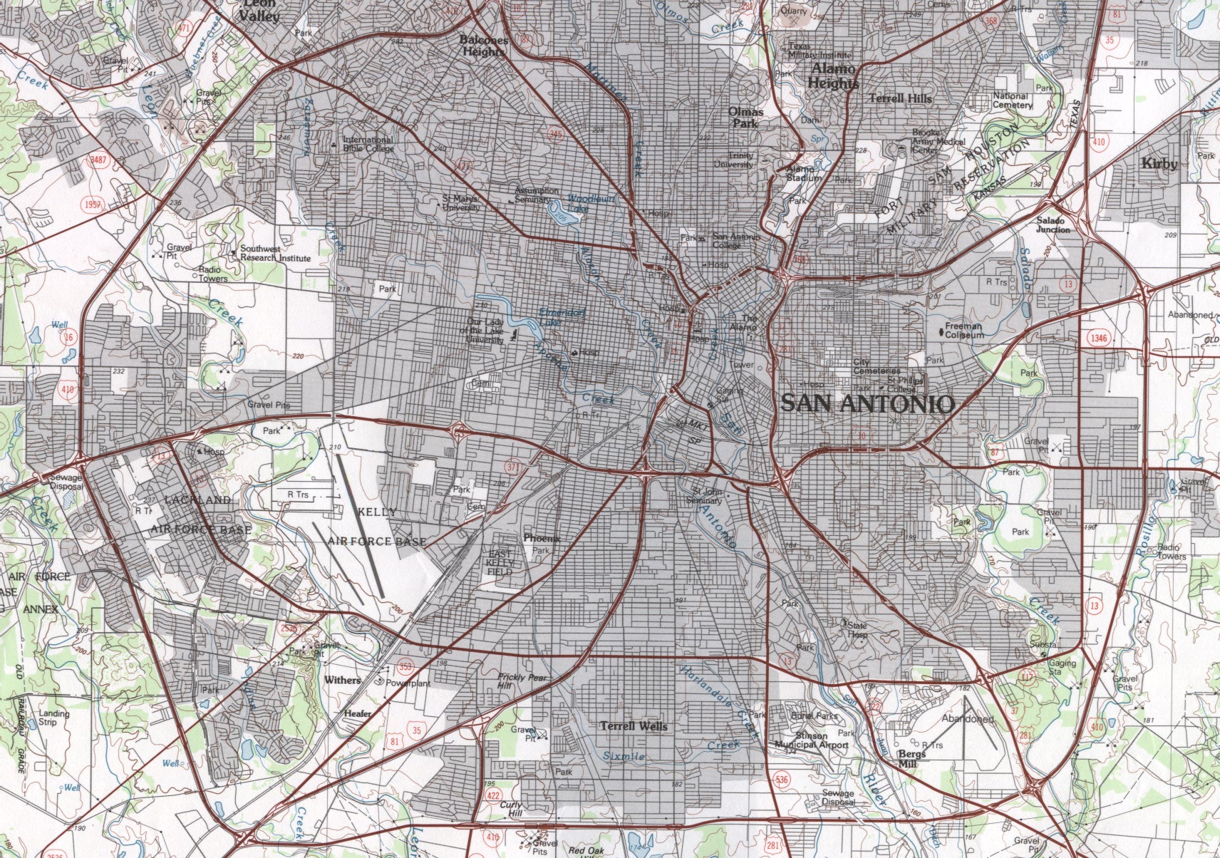
This is a planimetric map of San Antonio. It displays the view of an area based upon natural features and uses exact coordinates to display the correct positions of buildings, roads, and other scenery. Planimetric maps like this one capture these details with a variety of horizontal lines and features. This map shows buildings and streets of the San Antonio area,
Planimetric Map Link
No comments:
Post a Comment